


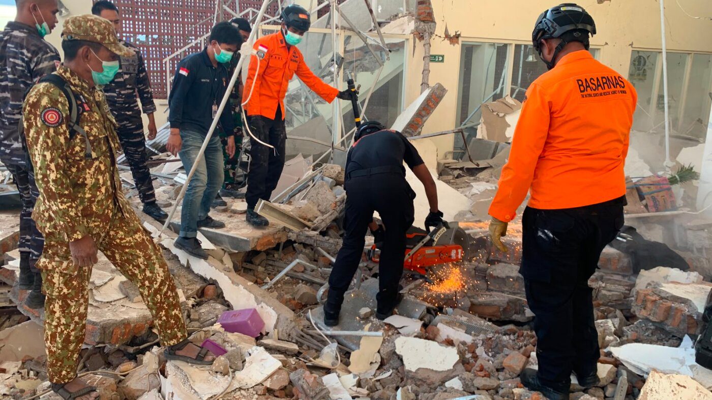
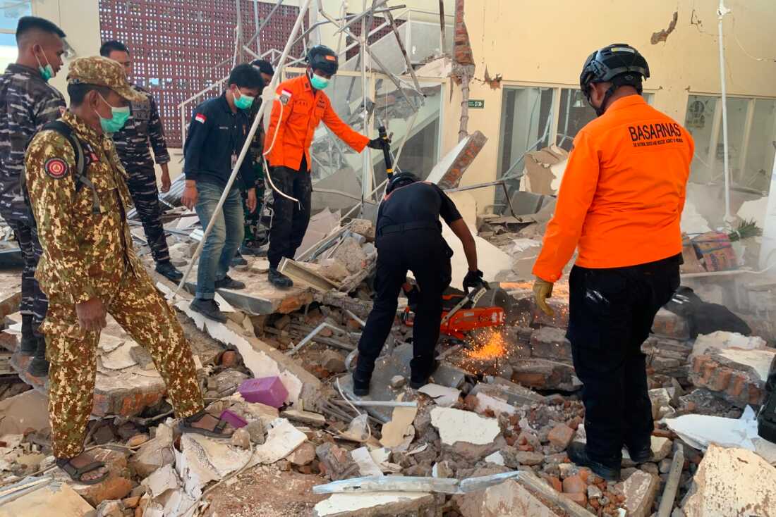
In this photo released by the Indonesian National Search and Rescue Agency (BASARNAS), rescuers attempt to clear debris at building damaged by an earthquake in Maumere, East Nusa Tenggara Province, Indonesia, Saturday, Aug. 15, 2026.
BASARNAS via AP
hide caption
toggle caption
BASARNAS via AP
MAUMERE, Indonesia — A powerful magnitude 7.7 earthquake struck off the coast of Indonesia early Saturday, killing at least 47 people, collapsing buildings and causing panic in a region prone to deadly quakes. Authorities said dozens more residents were injured and warned that the death toll would almost certainly rise.
Authorities issued a tsunami warning and urged coastal residents to move to higher ground, but later lifted the warning when Indonesia’s meteorological agency said monitoring showed no significant sea-level changes that posed a threat to coastal communities. Some smaller tsunamis were reported.
The U.S. Geological Survey said the quake hit eastern Indonesia’s Flores region at a depth of 10 kilometers (6 miles) at 5:58 a.m. local time. Its epicenter was 68 km (42 miles) north-northwest of the city of Ende in East Nusa Tenggara province.
The quake triggers landslides and generates small tsunamis
The meteorological agency said the quake was followed by at least 235 aftershocks, with the largest recorded at magnitude 6.2.
The agency’s sea-level monitoring stations acknowledged some small tsunamis reached coastal villages in Manggarai and East Manggarai regencies. Videos obtained by The Associated Press showed the coastal village of Riung in Ngada regency blanketed in mud and debris after what the agency described as a 1.61-meter (5.3 feet) tsunami. Fishing boats were stranded ashore, infrastructure damaged, and homes surrounded by sediment left by receding waters.
Waves measuring 0.94 meters (3.1 feet) were observed in Maurole, Ende Regency.
Tsunami waves exceeding 0.5 meters (1.6 feet) were detected in Bulukumba, South Sulawesi, and Sape in Bima Regency.
A strong, land-based earthquake of 6.9 magnitude hit North Sumatra province in western Indonesia on Saturday afternoon, according to the USGS. It struck 172.5 kilometers (107 miles) beneath the earth’s surface, meaning it was too deep to cause significant damage or casualties, Indonesian authorities said.
The quake has caused buildings to collapse
East Nusa Tenggara Police Chief Rudi Darmoko said power outages hampered the spread of information about the impact of the earthquake in cities and villages, complicating search and rescue efforts.
“We are continuing to collect reports of damage and casualties, but there are communication disruptions,” Darmoko said. He said quake-triggered landslides in Ende regency blocked the Trans-Flores highway, a roughly 700-kilometer (435-mile) paved mountain road spanning Flores Island, from Labuan Bajo to Larantuka.
The head of the National Disaster Management Agency, Suharyanto, said rescuers have recovered at least 47 bodies, mostly in Sikka, Manggarai and East Manggarai, and at least 50 people were taken to hospitals.
Suharyanto, who like many Indonesians uses a single name, said the quake flattened at least 157 houses and damaged nearly 200 more, forcing about 2,000 villagers to abandon their homes and move to temporary shelters. The powerful temblor also destroyed more than 100 public facilities, including schools, medical centers and churches.
The death toll could rise because landslides triggered by the earthquake buried or cut off many remote villages across six regencies on Flores Island, said Fathur Rahman, who heads the Search and Rescue Office in Maumere, the capital of Sikka.
Some remote villages are completely buried, he said, and damaged infrastructure and a lack of heavy equipment were hindering rescue efforts.
Authorities deployed three helicopters and a rescue vessel to support logistics and emergency response operations, including potential evacuations. East Nusa Tenggara consists of numerous islands and presents significant transportation and access challenges.
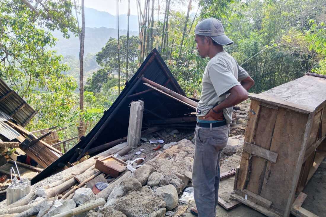
A man examines the damage to a building following an earthquake in East Manggarai, East Nusa Tenggara province, Indonesia, Saturday, Aug. 15, 2026.
Kurniawan/AP
hide caption
toggle caption
Kurniawan/AP
Residents ran for their lives when the quake struck
The quake was felt across much of Flores island with initial reports indicating heavy damage.
Yohanna Embu, who lives in Sikka, said people ran in a panic to higher ground.
“Many buildings here were damaged … I saw that the waiting room at the port terminal in Maumere had collapsed,” she said.
Students at St. Peter Major Seminary in Sikka who were attending morning Mass fled when the roof of an assembly hall collapsed, said the Rev. Guidelbertus Tanga, rector of the seminary, known locally as Ritapiret Seminary on the predominantly Catholic island of Flores.
“Our students and nuns ran out in panic beneath a collapsing roof,” Tanga said. “At least one priest suffered a broken leg after jumping from the second floor of a building during the quake.”
The quake also struck Labuan Bajo, a gateway town to eastern Indonesia’s Komodo National Park, one of the country’s best-known attractions. Damage was reported in Bima, a city in neighboring West Nusa Tenggara province, and in parts of southern Sulawesi island.
Indonesian authorities initially issued a tsunami warning for parts of East Nusa Tenggara, West Nusa Tenggara, South Sulawesi and Southeast Sulawesi provinces, and urged residents to stay away from beaches and riverbanks. The agency located the shallow undersea quake near Flores island.
Indonesia, a vast archipelago of more than 17,000 islands, is prone to earthquakes and volcanic activity because of its location on the “Ring of Fire,” an arc of volcanoes and fault lines in the Pacific Basin.
Most notably, a powerful earthquake caused a tsunami in 1992 that killed about 2,500 people on Flores, part of a group of islands in the eastern half of Indonesia, while in 2018, a magnitude 7.5 quake spawned a large localized tsunami that wiped out coastal areas, killing more than 4,400 people.
In December 2004, a massive magnitude 9.1 earthquake off Sumatra in western Indonesia triggered a tsunami that killed 230,000 people in a dozen countries.

