

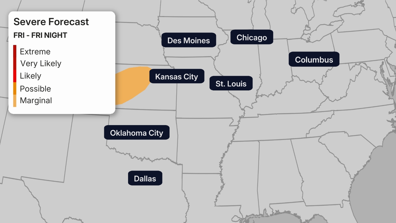
A severe weather outbreak will continue Monday, bringing the threat of strong to intense tornadoes (EF2/EF3+), very large hail, damaging winds and flooding rainfall to parts of the Plains and Midwest.
Below you’ll find maps that will help you track the severe weather.
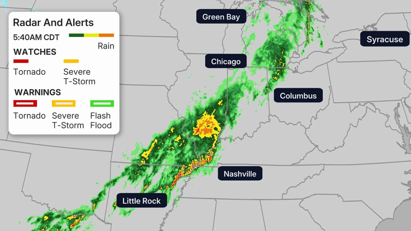
Current Radar
(MORE: What Are The Different Types Of Tornado Warnings?)
Storm Reports
(MORE: Severe Weather Safety 101)
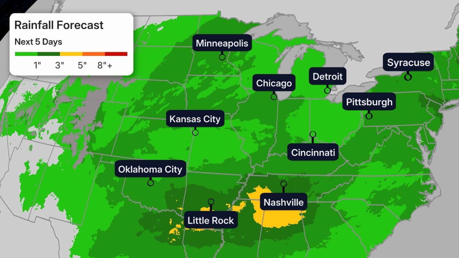
Flooding Rain
(MORE: How To Stay Safe During A Flood)

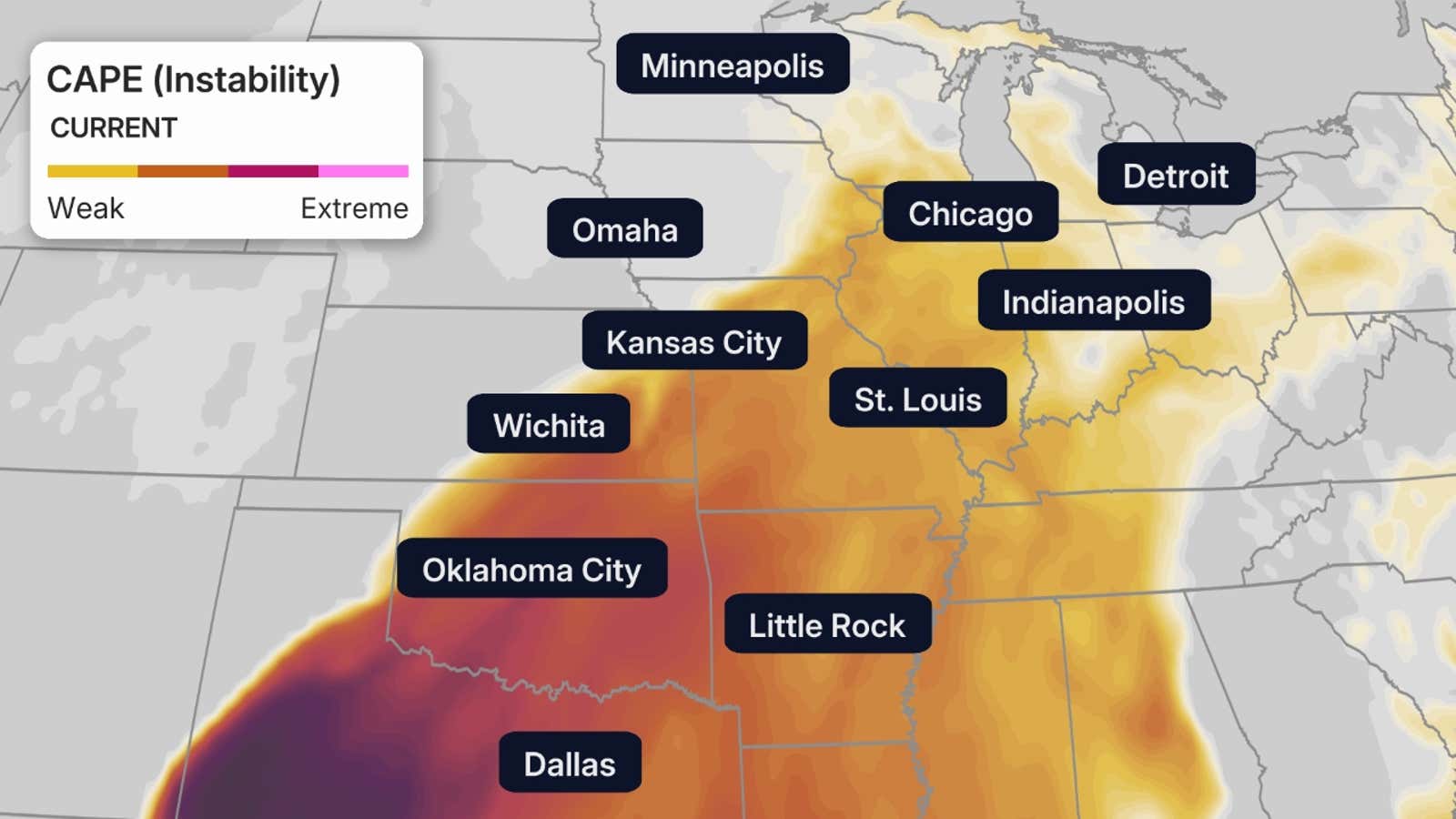
Instability
CAPE (Convective Available Potential Energy) measures the amount of instability in the atmosphere and is essential for thunderstorm development. The higher the CAPE, the higher the probability of thunderstorm development.
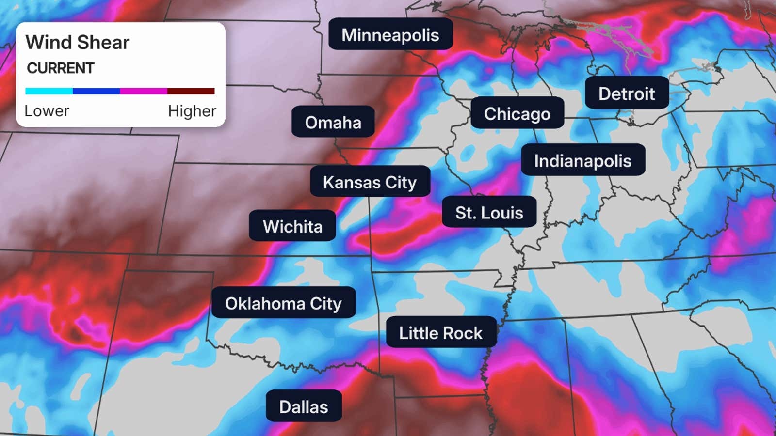
Wind Shear
Wind shear is the change in wind speed or direction with height, a key ingredient in thunderstorm development, especially severe storms.
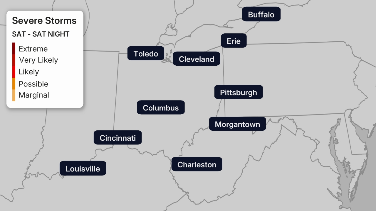
More Severe Weather Tuesday
Severe thunderstorms are possible again on Tuesday from the Southern Plains to the Great Lakes, however the tornado threat is expected to be lower. Stay up to date with the forecast here.
Caitlin Kaiser graduated from the Georgia Institute of Technology with both an undergraduate and graduate degree in Earth and Atmospheric Sciences before starting her career as a digital meteorologist with weather.com.